| The
Veins of Life
 Watershed Society
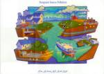
NON-POINT SOURCE POLLUTION 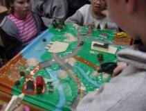
Non-point source pollution comes from many sources. Non-point source pollution includes metals and oil residue from cars, soil eroded from construction sites, improper boating practices, pesticides and herbicides from fields and lawns, road salts, litter, improperly discarded household wastes, leaking septic systems, animal wastes from farms and household pets, large amounts of grass clippings, leaves and other natural materials.
Click on image
to view. Non-point
source pollution remains a leading threat to water quality in
A Closer look at Urban Runoff
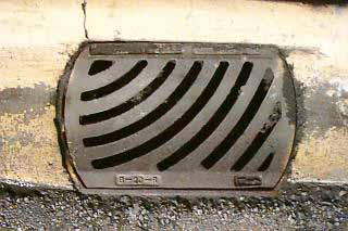
In an urban landscape, storm drain systems take the place of natural systems and provide a corridor to transport excess water that occurs on the earth's surface. Excess water comes from heavy rains, snowmelt, or excess human watering that can't infiltrate into the earth's surface due to concrete, buildings, or because the soil can't hold any more water. This water is called runoff. Runoff travels over the earth's surface layer picking up and transporting pet wastes, car-washing residues, garbage, pesticides, paints, oil, and other household chemicals. The runoff carries these pollutants to the storm drain or catch basin. This is called non-point source pollution because we don't know where the pollution originates. Once the runoff enters the storm drain it enters pipes that carry it to larger pipes or "trunk lines" buried underground. Outfalls mark the end point of the storm drain system and the storm water enters into local waterways without being treated in any way. Storm drains act like a stream collecting runoff from the land, but do not contain or create the natural features associated with a stream. Non-point source pollution enters into surface and ground waters. When it rains or snow melts, the water flows as runoff transporting various types of pollution over the landscape, into groundwater, and into our local streams, lakes, and oceans. It eventually becomes part of the water cycle. Keeping rain and snowmelt on the surface instead of soaking into the ground reduces the amount of groundwater upon which some communities depend for drinking water. Impervious layers cause groundwater levels to drop, decreasing the amount of water to keep streams flowing in the summer. Streams may fall below the minimum level needed to support fish, wildlife, recreation, and other uses. Impervious surfaces include surfaces that cannot be effectively/easily penetrated by water. Examples: pavement, buildings, and compacted soils. There is a growing body of scientific evidence indicating that there is a direct link between impervious surface coverage and degradation of streams. Even levels as low as 10-15% impermeable surface coverage in a watershed can make maintaining stream quality problematic. Greater impervious surface area coverage (15-20%) has been linked to dramatic changes in the shape of streams, water quality, water temperatures, and the health of insects, amphibians, and fish living in these streams. Urban sprawl is the major cause of impervious surfaces in a watershed. As the population increases, housing, roads, parking lots, etc. are expanding and creating more and more storm water that eventually ends up in nearby creeks, and on beaches. TAKE A LOOK AT A SATELLITE IMAGE OF THE GORGE WATERSHED!
© 2009 Veins of Life Watershed Society / All Rights Reserved / if you wish to use any info for commercial or non commercial usage you must obtain permissions from The Veins of Life Watershed Society |
| Last Updated: August 2007 |